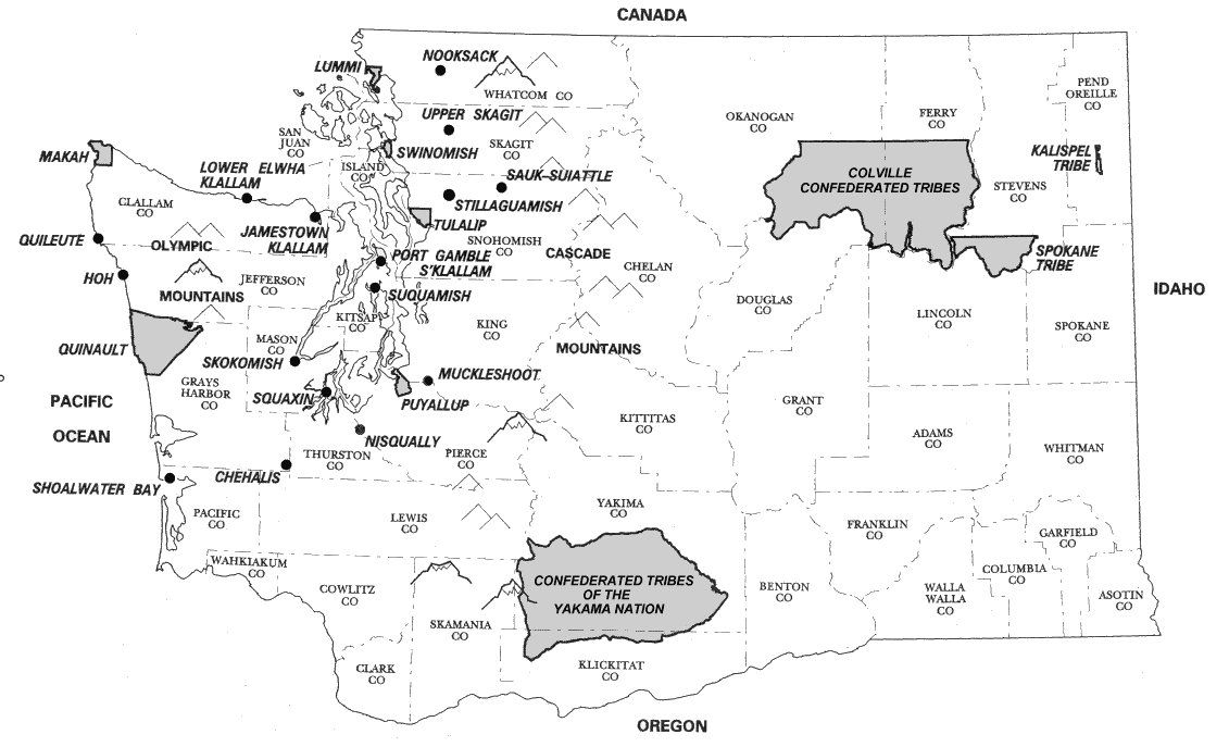
Just to brush up on our geography, I thought that I'd post a map of the Pacific Northwest, the part of our country where the Coyote Tales we read came from. (The map is from Sheppard/Wood Distributors, a commercial warehouse and distribution company from Boise.)
"Coyote and Bull" and "Coyote and the Mallard Ducks" came from the Nez Perce, so I thought I would begin with a little information about this people, but while we are posting maps, I will post a map of the territory held by the Nez Perce in the 19th century. This map is from the Chief Washakie Foundation's web site.

Adam Kittleson's article from Minnesota State University at Mankato's E-museum is a good place to begin.
https://web.archive.org/web/20100228202717/http://www.mnsu.edu/emuseum/cultural/northamerica/nez_perce.html
This history is from the Nez Perce tribal government's official website:
https://web.archive.org/web/20100122032113/http://www.nezperce.org/history/nimiipu.htm
https://web.archive.org/web/20100213233815/http://www.nezperce.org/Official/historyfaq.htm
For more detailed information, see this article by Deward E. Walker, Jr. and Peter N. Jones:
http://content.lib.washington.edu/aipnw/walker.html
The Nez Perce were also among the many peoples that the Lewis and Clark Expedition met on their way to the Pacific Ocean.
http://www.pbs.org/lewisandclark/native/nez.html
The Nez Perce were also known for their Appaloosa horses:
http://www.nezperce.com/npedu13a.html
If you don't know what an Appaloosa horse looks like, here is a picture below. The picture is a public domain photograph from Wikimedia Commons.

Chief Joseph (1840-1904) was also one of the most famous Nez Perce. For his story, see this link: http://www.pbs.org/weta/thewest/people/a_c/chiefjoseph.htm
This biography is also interesting:
http://www.windriverhistory.org/exhibits/chiefjoseph/chiefjoseph01.htm
The picture of Chief Joseph below is from Wikimedia Commons. It was taken in 1877.
Here Jeff Head writes about his travels along the Nez Perce trail. The pictures are beautiful!
http://www.jeffhead.com/magruder/index.htm
On to the Wishram, the people who gave us "Coyote and Eagle in the Land of the Dead." They once lived along the Columbia River, the border between Oregon and Washington. At one point, they were relocated to the Yakama Reservation, about 100 miles north of this area.
As you may see from this free map from the Map Company, quite a few groups lived in this area. The map below shows where the Wishram live now as part of the Yakama Confederation.
Here is a little more information about the Wishram:
http://www.nationalgeographic.com/lewisandclark/record_tribes_064_13_33.html
http://www.pbs.org/lewisandclark/native/wis.html
For more information about the Yakama Nation, see this site. Scroll down past the ads for an interesting article.
http://www.ohwy.com/wa/y/yakamana.htm
Below is a Wikimedia Commons picture of Wishram petroglyphs at a site called Wishram Village. It is now part of a national park near The Dalles, Oregon.

Scroll down for more information about Wishram Village or Nixluidix:
http://www.waymarking.com/waymarks/WMYPK
The picture below is from www.waymarking.com.

The story of She Who Watches is also from the Wishram:
http://www.lensjoy.com/gallery/20.htm
The photo below is by Chris Carvalho.

With the Shoshone and "Wolf Tricks the Coyote Trickster," we return to Idaho. Finding a map for the Shoshone is particularly difficult since their one-time territory was so large. The map below is from Boise State University's magazine Idaho Issues Online. Here are a few pieces to put together, but I will provide only an overview and focus on the Shoshone within Idaho since the story about Wolf and Coyote is from the Lemhi-Shoshone.
For more information about the Shoshone, see these sites:
http://www.shoshoneindian.com/
http://www.nationalgeographic.com/lewisandclark/record_tribes_017_11_8.html
This site also includes audiofiles as well:
https://web.archive.org/web/20080515074417/http://www.wisdomoftheelders.org/program301.html
Lewis and Clark's guide Sacajawea was a member of the Shoshone although she had been kidnapped away from her tribe and sold into slavery. The illustration below is from the Chief Washakie Foundation's website.
http://www.shoshoneindian.com/sacajawea_001.htm

Here is a web article on Chief Washakie, an Eastern Shoshone chief who lived into the 20th century.
http://www.windriverhistory.org/exhibits/washakie_2/index.htm
Below is a picture of Idaho's Snake River, along which the Shoshone lived. This picture came from the University of Montana-Missoula's Regional Learning Project.

Leslie Marmon Silko (whose poems I read on Monday) is descended from the Laguna Pueblo in New Mexico. As we learned from reading "Franz Boas' Visit," she also has white ancestry. The map below is from Prof. S.J. Crouthamel's site for his course, Introduction to American Indian Studies at Palomar College.

The Pueblo is a much larger group, but I thought I'd begin with an overview.
https://web.archive.org/web/20090222025653/http://www.cabq.gov/aes/s3pueblo.html
Writing in 1932, James Paytiamo explains how the Laguna Pueblo came to be and were named.
http://southwestcrossroads.org/record.php?num=508
This history is more formal and less anecdotal:
http://southwestcrossroads.org/record.php?num=665

This profile essay on Leslie Marmon Silko also gives you a little background on the Laguna Pueblo.
https://facultystaff.richmond.edu/~rnelson/woman.html
Here is an extended interview with Ms. Marmon Silko:
http://www.altx.com/interviews/silko.html
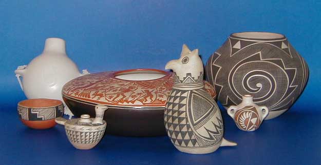
The Laguna Pueblo are also known for their pottery:
http://www.clayhound.us/sites/laguna.htm
The picture below is also from www.clayhound.us .

I will finish up with information about the Anishinaabe, Gerald Vizenor's background. This people lives in the upper Midwest, in Minnesota. Specifically, Vizenor is a member of the Minnesota Chippewa Tribe, White Earth Reservation (see the map from Native Wiki further below).

For more information about the Minnesota Chippewa, see the site below:
https://web.archive.org/web/20090404051854/http://www.mnchippewatribe.org/a_brief_history.htm
This site has quite a bit of information about the White Earth Reservation:
http://www.kstrom.net/isk/maps/mn/whitearth.htm
With our current interest in biodiversity and local food, the wild rice has become more and more important:
https://web.archive.org/web/20100113111156/http://www.savewildrice.org/
A branch of the Anishinaabe are based in Canada. Anishinaabe-Canadian Norval Morisseau's work is depicted below. I found this image at virtualmuseum.ca , an online collection of images from Canada's museums.


No comments:
Post a Comment